Walking in Majorca: the 10 best walks in Mallorca, including the GR 221
Ten walks of 6 to 18 km, three of them on the GR 221, with distance, walking time, difficulty, refuge prices and the official safety warnings.

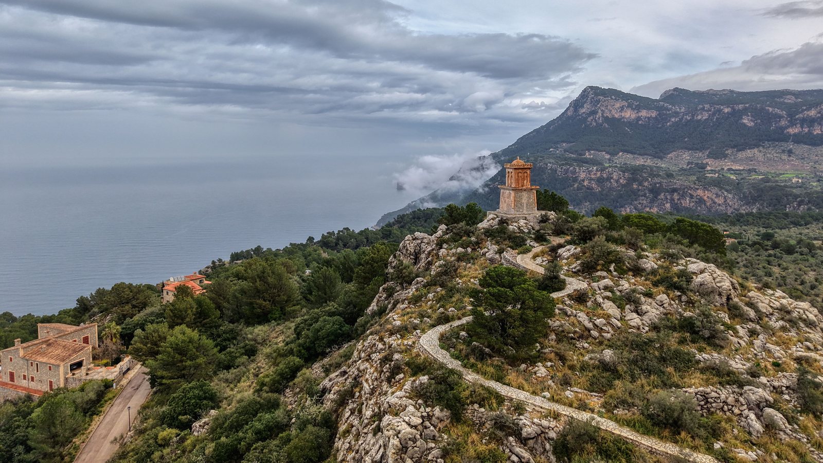
The ten best walks in Mallorca mostly run through the Serra de Tramuntana: three stages of the long-distance GR 221, plus Cúber–Biniaraix, the Castell d'Alaró, the Torrent de Pareis, the Puig Tomir and the old path from Lluc to Pollença. Add to that the island of sa Dragonera in the west and the Llevant peninsula in the east. All figures come from the Consell de Mallorca and the Balearic Government, as of October 2026.
The 10 walks at a glance
| Rank | Walk | Distance | Walking time | Difficulty (official) |
|---|---|---|---|---|
| 1 | GR 221: Deià (Can Boi) – Sóller (Muleta) | 9.9 km | 3 h 06 min | easy |
| 2 | Cúber – Biniaraix | 10.7 km | 2 h | moderate |
| 3 | Castell d'Alaró | 10.6 km | 2 h | easy |
| 4 | GR 221: Tossals Verds – Son Amer | 15.1 km | 5 h 35 min | moderate |
| 5 | Torrent de Pareis | gorge down to sa Calobra | not stated | difficult |
| 6 | Puig Tomir | 6.2 km | 3 h | difficult |
| 7 | Old path from Lluc to Pollença | 17.8 km | 4 h 30 min | easy |
| 8 | GR 221: Port d'Andratx – Sant Elm | 9.2 km | 3 h 20 min | easy |
| 9 | Sa Dragonera: Far de Llebeig | 9.2 km there and back | 3 h | easy |
| 10 | Llevant: Itinerari de sa Duaia | 6 km | 1 h 40 min | easy |
What is the GR 221?
The GR 221, the "Ruta de Pedra en Sec" (Dry Stone Route), crosses the Serra de Tramuntana from Port d'Andratx to Port de Pollença. According to the Consell de Mallorca, 261.1 km are open and waymarked (Consell de Mallorca). The only restriction is on the Esporles – Can Boi stage: the section through the Son Cabaspre housing estate is passable but not waymarked.
The stages end at refuges run by the Consell. A bed in a dormitory costs €14 per person per night including a shower, according to the Consell, or €9 for children up to 16. You book online through the Consell's Sede electrónica or by phone on +34 971 173 700.
| Refuge | Municipality | Beds |
|---|---|---|
| Can Boi | Deià | 32 |
| Muleta | Sóller | 30 |
| Tossals Verds | Escorca | 42 |
| Son Amer | Escorca | 52 |
| Pont Romà | Pollença | 38 |
1. GR 221: Deià (Can Boi) – Sóller (Muleta)
This short stage of the GR 221 links the Can Boi refuge in Deià with the Muleta refuge in Sóller (Consell de Mallorca). With 362 m of ascent and 385 m of descent, it is gentle for a Tramuntana stage.
- Distance and time: 9.9 km, 3 h 06 min, easy
- Getting there: bus 203 to Es Clot (about 340 m from the start)
- Overnight: Muleta refuge, 30 beds, €14 per night
2. Cúber – Biniaraix
The path leads from Cúber to Biniaraix near Sóller. The Balearic Government lists it as moderate, with 10.7 km and about 2 hours (GOIB, Serra de Tramuntana).
- Distance and time: 10.7 km, 2 h, moderate
- Getting there: The start and finish are far apart, so plan your return from Biniaraix or Sóller in advance.
- Good to know: If the path crosses private estates, the authority says you need the owners' permission. Lighting fires and camping require a permit all year round.
3. Castell d'Alaró
The path climbs up to the Castell d'Alaró. The Government gives 10.6 km and 2 hours and rates it as easy (GOIB, Serra de Tramuntana).
- Distance and time: 10.6 km, 2 h, easy
- Overnight: S'Hostatgeria del Castell d'Alaró (821 m), 30 beds, tel. +34 971 182 112. It lies on a variant of the GR 221.
- Good to know: The hostatgeria only gives prices for rooms and meals on request.
4. GR 221: Tossals Verds – Son Amer
This stage links two refuges in the heart of the Tramuntana: Tossals Verds (525 m) and Son Amer (530 m), both in the municipality of Escorca. 869 m of ascent and 848 m of descent (Consell de Mallorca).
- Distance and time: 15.1 km, 5 h 35 min, moderate
- Getting there: no bus stop near the refuges
- Overnight: Tossals Verds refuge (42 beds) and Son Amer (52 beds), €14 per night each
- Good to know: The previous stage, Muleta – Tossals Verds, is the longest at 27.8 km and 9 hours. Because of the height difference, the Consell recommends walking it the other way, from Tossals Verds to Muleta.
5. Torrent de Pareis
The gorge starts at s'Entreforc, 150 m above sea level, where two streams meet, and ends at the beach of sa Calobra. The Government rates it as difficult (GOIB, Torrent de Pareis).
- Distance and time: no official figures
- Official warning: The water can rise suddenly. Do not set off if there is a weather warning (yellow, orange or red). If you don't know the gorge, don't start from sa Calobra: it is harder from that end and easier to get lost.
- Good to know: Groups of 40 or more need a permit.
6. Puig Tomir
For the climb up the Puig Tomir, the Government gives 6.2 km and 3 hours and rates it as difficult (GOIB, Serra de Tramuntana).
- Distance and time: 6.2 km, 3 h, difficult
- Good to know: The authority does not give the ascent. If the path crosses private estates, you need the owners' permission.
7. Old path from Lluc to Pollença
The Camí Vell leads from Lluc to Pollença: 17.8 km, about 4 hours 30 minutes, rated easy by the Government (GOIB, Serra de Tramuntana).
- Distance and time: 17.8 km, 4 h 30 min, easy
- Overnight: at the finish, the Pont Romà refuge in Pollença (38 beds)
- Good to know: From Pont Romà it is another 6.7 km on the GR 221 to Port de Pollença, the end of the long-distance route.
8. GR 221: Port d'Andratx – Sant Elm
The first stage of the GR 221 links two coastal villages in the south-west: 9.2 km, 3 hours 20 minutes, 372 m up and down, easy (Consell de Mallorca).
- Distance and time: 9.2 km, 3 h 20 min, easy
- Getting there: bus 101, 121 or 122 to S'Aluet in Port d'Andratx, back on bus 121 from Sant Elm
- Good to know: At the finish is Sant Elm beach, which has a Blue Flag.
9. Sa Dragonera: Far de Llebeig
The island of sa Dragonera is a nature park. The path to the Far de Llebeig lighthouse is 9.2 km long (there and back), takes 3 hours and is easy (GOIB, sa Dragonera).
- Distance and time: 9.2 km there and back, 3 h, easy
- Getting there: by boat. The park is open every day unless the weather makes the crossing impossible.
- Good to know: Groups of more than 10 need a permit from the park management in advance.
10. Llevant: Itinerari de sa Duaia
The Llevant Peninsula Nature Park near Artà has more than 30 official paths. The sa Duaia path is 6 km long, takes 1 hour 40 minutes and is easy (GOIB, Península de Llevant).
- Distance and time: 6 km, 1 h 40 min, easy
- Good to know: The authority warns of a high forest fire risk. Groups of more than 60 need a permit.
Before you set off
- s'Albufera: According to the Balearic Government, s'Albufera Nature Park near Muro is closed until 2 November, and its paths are closed until then.
- GR 222 (Artà – Lluc): According to the Consell, four sections are still "under construction" and not waymarked: Artà – Coll des Racó, Cala Estreta – Arenalet d'Albarca, Son Serra de Marina – Santa Margalida and Santa Margalida – Inca.
- Puig de Massanella: We left this climb out because we could not find a readable official source on the route and access.
How we chose
Our basis is the GR 221 stages from the Consell de Mallorca and the Balearic Government's 88 official paths in protected areas. We chose walks that together cover the mountains, the coast and the islands, with easy, moderate and difficult routes. Distance, walking time and difficulty come from the authorities; they only give the ascent for the GR 221.
Sources and image rights
- Source
- Ruta de Pedra en Sec GR 221 (Consell de Mallorca)
- Images
- Pedro Luis Domínguez Ruiz / Pexels (conditions)
- Checked
- 24 October 2026 by Andreas Lakeberg
Has a market day, an opening time or a price changed? Write to contact@top10mallorca.com. We check every tip at the source and note changes at the top of the list.
Legal notice. This list summarises rules in general terms and is not legal advice. Only the linked regulations in their current version and the information from the responsible authority, such as the town hall, the Consell de Mallorca or the Balearic Government, are authoritative. Information as of 24 October 2026.
Disclaimer. We research every list carefully and to the best of our knowledge. Market days, opening times, prices and local rules change, so we cannot guarantee that all information is complete, current and correct. Check anything important with the original source before you go. To the extent permitted by law, we accept no liability for errors or omissions.